SEARCH
Date and Time | Mag Depth | Nearest Volcano | Location | Details | Map |
|---|---|---|---|---|---|
| Nov 27, 1980 01:26 am (New York) | 2.5 5 km | 32 km (20 mi) to the S | Info | ||
| Wednesday, November 5, 1980 GMT (1 quake) | |||||
| Nov 5, 1980 09:48 pm (Universal Time) | 3.0 2.2 km | 174 km (108 mi) to the SE | Info | ||
| Monday, August 25, 1980 GMT (1 quake) | |||||
| Aug 25, 1980 11:41 am (Universal Time) | 2.0 1 km | 54 km (34 mi) to the SW | Info | ||
| Saturday, August 23, 1980 GMT (1 quake) | |||||
| Aug 23, 1980 03:49 am (Universal Time) | 3.1 5 km | 109 km (68 mi) to the SW | Info | ||
| Wednesday, August 20, 1980 GMT (1 quake) | |||||
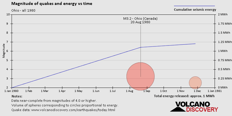
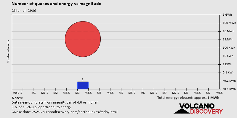
| Aug 20, 1980 09:34 am (Universal Time) | 3.2 5 km | 8 km (5 mi) to the N | Info | ||
| Thursday, July 31, 1980 GMT (1 quake) | |||||
| Jul 31, 1980 09:26 am (Universal Time) | 2.2 12 km | 52 km (32 mi) to the SW | Info | ||
| Sunday, July 27, 1980 GMT (3 quakes) | |||||
| Jul 27, 1980 02:52 pm (New York) | 5.0 10 km | 54 km (34 mi) to the SW | Info | ||
| Jul 27, 1980 02:52 pm (New York) | 5.2 8 km | 55 km (34 mi) to the S | Info | ||
| Jul 27, 1980 02:52 pm (New York) | 5.2 8 km | 55 km (34 mi) to the S | Info | ||
| Saturday, July 12, 1980 GMT (1 quake) | |||||
| Jul 12, 1980 11:59 pm (Universal Time) | 3.1 0 km | 279 km (173 mi) to the SW | Info | ||
| Tuesday, April 22, 1980 GMT (1 quake) | |||||
| Apr 21, 1980 11:14 pm (New York) | 2.5 5 km | 262 km (163 mi) to the SE | Info | ||

| or | ||
Look up quakes! | ||