

Translate
Portus Moresbiensis, National Capital (532.7 km SW of epicenter) [Map] / Weak shaking (MMI III) (reported through our app)


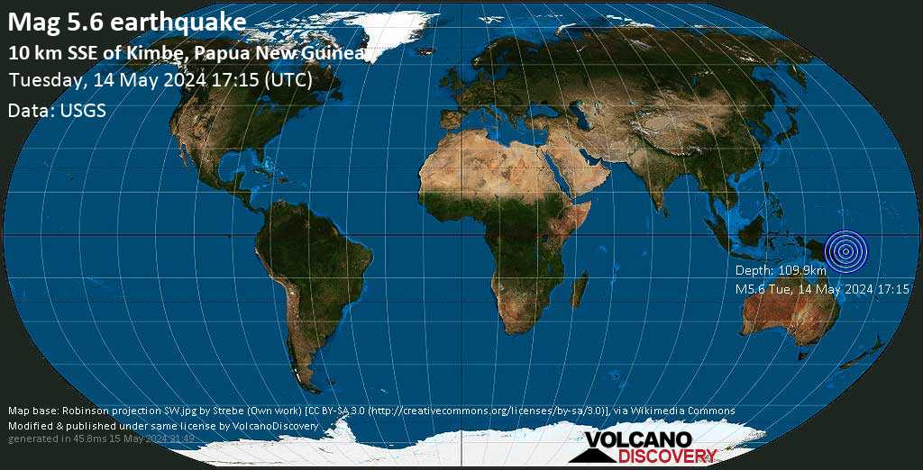
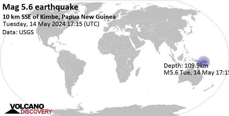
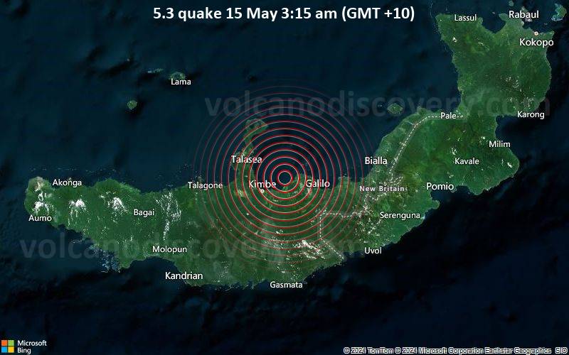
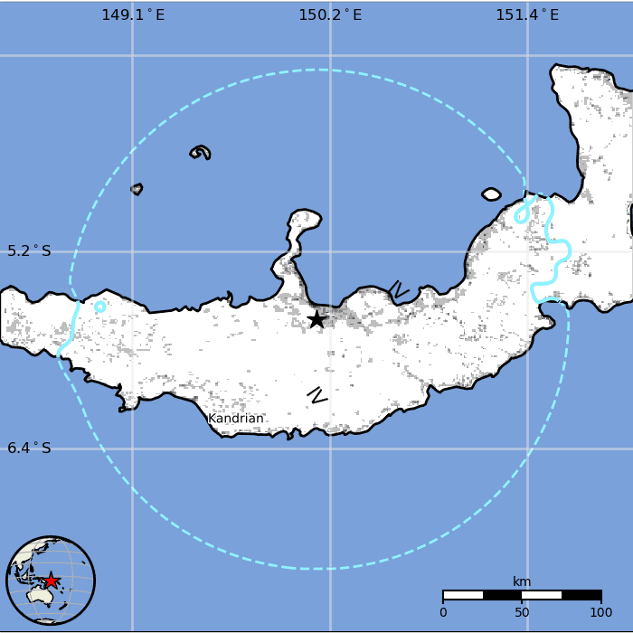
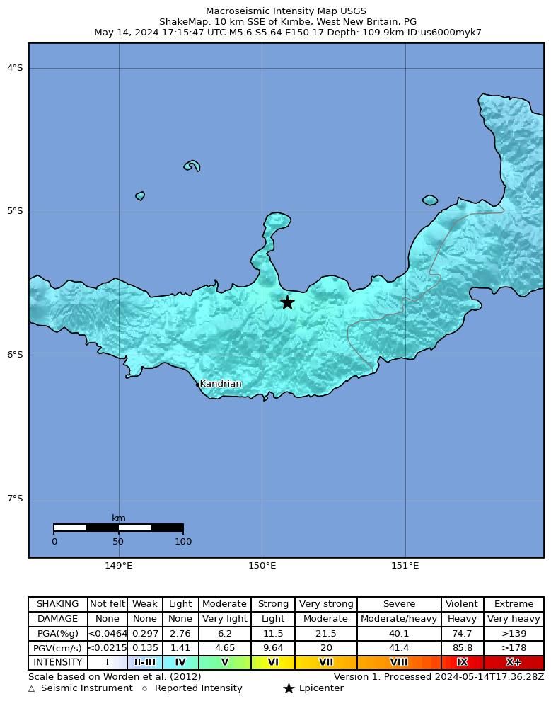
A strong magnitude 5.6 earthquake hit 10.9 km (7 mi) away from Kimbe, West New Britain, ![]() Papua New Guinea, in the early morning of Wednesday, May 15, 2024 at 3.15 am local time (Pacific/Port Moresby GMT +10). The quake had a moderate depth of 121 km (75 mi) and was reported felt by some people near the epicenter.
Papua New Guinea, in the early morning of Wednesday, May 15, 2024 at 3.15 am local time (Pacific/Port Moresby GMT +10). The quake had a moderate depth of 121 km (75 mi) and was reported felt by some people near the epicenter.
No significant damage or impact is expected from this quake and no particular alert was issued.
| Date & time | May 14, 2024 17:15:48 UTC - |
| Local time at epicenter | Wednesday, May 15, 2024, at 03:15 am (Pacific/Port Moresby GMT +10) |
| Status | Confirmed |
| Magnitude | 5.6 |
| Depth | 121 km |
| Epicenter latitude / longitude | 5.6475°S / 150.1558°E |
| Seismic antipode | 5.6475°N / 29.844°W |
| Shaking intensity | IV Light shaking near epicenter |
| Felt | 1 report |
| Primary data source | USGS (United States Geological Survey) |
| Nearest volcano | Garbuna (26 km / 16 mi) |
| Weather at epicenter at time of quake | Overcast Clouds  24.5°C (76 F), humidity: 95%, wind: 2 m/s (4 kts) from S 24.5°C (76 F), humidity: 95%, wind: 2 m/s (4 kts) from S |
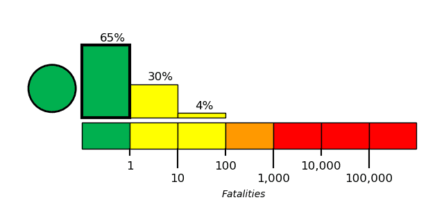
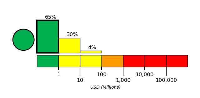
| Estimated seismic energy released | 1.6 x 10¹³ joules (4.4 gigawatt hours, equivalent to 3788 tons of TNT or 0.2 atomic bombs!) | about seismic energy |
MMI Level Shaking |
 (362,400 in total) (362,400 in total) | Possible damage |
|---|---|---|
| I Not felt | - | None |
| II Very weak | - | None |
| III Weak | 53,000 (14.62%) | Probably none |
| IV Light | 309,400 (85.38%) | None or minor only |
| V Moderate | - | Minor |
| VI Strong | - | Minor to Moderate |
| VII Very strong | - | Moderate |
| VIII Severe | - | Significant |
| IX Violent | - | Heavy |
| X Extreme | - | Catastrophic |

Distance |
Place | Max. shaking intensity(*) | Region | Country |
|---|---|---|---|---|
| 11 km (7 mi) N of epicenter |
Kimbe (pop: 18,800) |
IV: Light |
West New Britain | |
| 92 km (57 mi) SW of epicenter |
Kandrian (pop: 1,010) |
IV: Light |
West New Britain | |
| 275 km (171 mi) NE of epicenter |
Rabaul (pop: 8,070) |
III: Weak |
East New Britain | |
| 275 km (171 mi) NE of epicenter |
Kokopo (pop: 26,300) |
III: Weak |
East New Britain | |
| 349 km (217 mi) N of epicenter |
Kavieng (pop: 14,500) |
III: Weak |
New Ireland | |
| 369 km (229 mi) W of epicenter |
Lae (pop: 76,300) |
III: Weak |
Morobe | |
| 407 km (253 mi) SW of epicenter |
Popondetta (pop: 28,200) |
II: Very weak |
Sohe, Northern | |
| 424 km (263 mi) SW of epicenter |
Wau (pop: 14,600) |
II: Very weak |
Bulolo, Morobe | |
| 425 km (264 mi) SW of epicenter |
Bulolo (pop: 16,000) |
II: Very weak |
Morobe | |
| 448 km (278 mi) SW of epicenter |
Kokoda (pop: 6,200) |
II: Very weak |
Sohe, Northern | |
| 480 km (298 mi) W of epicenter |
Kainantu (pop: 8,510) |
II: Very weak |
Eastern Highlands | |
| 486 km (302 mi) W of epicenter |
Madang (pop: 27,400) |
II: Very weak |
Madang | |
| 514 km (319 mi) NW of epicenter |
Lorengau (pop: 5,810) |
II: Very weak |
Manus | |
| 520 km (323 mi) S of epicenter |
Alotau (pop: 10,000) |
II: Very weak |
Milne Bay | |
| 530 km (329 mi) W of epicenter |
Goroka (pop: 18,500) |
II: Very weak |
Eastern Highlands | |
| 540 km (335 mi) SW of epicenter |
Portus Moresbiensis (pop: 283,700) |
II: Very weak |
National Capital | |
| 548 km (341 mi) SW of epicenter |
Kerema (pop: 5,650) |
II: Very weak |
Gulf | |
| 555 km (345 mi) S of epicenter |
Samarai (pop: 1,640) |
II: Very weak |
Milne Bay | |
| 575 km (358 mi) W of epicenter |
Kundiawa (pop: 9,380) |
II: Very weak |
Chimbu | |
| 594 km (369 mi) E of epicenter |
Panguna (pop: 2,920) |
II: Very weak |
Bougainville | |
| 602 km (374 mi) E of epicenter |
Arawa (pop: 40,300) |
II: Very weak |
Bougainville |
| Place | Distance from epicenter | Average reported Shaking Intensity | Nr. of reports |
|---|---|---|---|
| Portus Moresbiensis, National Capital, (Pop.: 283,733) | 540 km (335 mi) SW of epicenter | III: Weak shaking | 1 |
| Shaking intensity | Number of reports | Min-Max distance from epicenter (*) | Average distance (*) |
|---|---|---|---|
| III: Weak shaking | 1 | 532–532 km (331–331 mi) | 532 km (331 mi) |
| Mag | Depth | Time GMT 2024-05-14 |
Epicenter | Agency |
|---|---|---|---|---|
| 5.6 | 121 km 75 mi |
17:15:48 | - 10 km S of Kimbe, Papua New Guinea | USGS (United States Geological Survey) |
| 5.6 | 124 km 77 mi |
17:15:49 | New Britain Region, P.n.g. 5.3 km (3.3 mi) epicenter difference with USGS |
EMSC (European-Mediterranean Seismological Centre) |
| 5.6 | 138 km 86 mi |
17:15:51 | New Britain Region, Papua New Guinea 12 km (7.4 mi) epicenter difference with USGS |
GFZ (German Research Centre for Geosciences) |
| 5.5 | 131 km 82 mi |
17:15:51 | near Port Moresby 22 km (14 mi) epicenter difference with USGS |
RENASS (Réseau National de Surveillance Sismique (RéNaSS)) |
| 5.4 | 133 km 83 mi |
17:15:47 | New Britain Region, Papua New Guinea 9.4 km (5.9 mi) epicenter difference with USGS |
BMKG (Meteorological, Climatological, and Geophysical Agency of Indonesia) |
| 5.6 | 131 km 81 mi |
17:15:51 | Papua New Guinea [Land] 6.8 km (4.2 mi) epicenter difference with USGS |
INGV (Istituto Nazionale di Geofisica e Vulcanologia) |
| 5.5 | 122 km 76 mi |
17:15:49 | New Britain Region, Papua New Guinea 6.4 km (4 mi) epicenter difference with USGS |
GeoAu (Geoscience Australia ) |
| 5.6 | 10 km 6.2 mi (*) |
17:15:47 | New Britain Region, P.N.G. 2.5 km (1.5 mi) epicenter difference with USGS |
IRIS (Incorporated Research Institutions for Seismology) |
Date and Time GMT | Mag Depth | Distance | Region | Details |
|---|---|---|---|---|
| May 15, 2024 03:15 am (Port Moresby) 5 weeks ago | 5.6 121 km | 0 km - This quake | 10.9 km S of Kimbe, West New Britain, Papua New Guinea Main Shock (this quake) | More |
Date and Time | Mag Depth | Distance | Location | Details | Map |
|---|---|---|---|---|---|
| May 2, 09:45 am (Port Moresby) | 5.9 29 km | 99 km (62 mi) to the E | Info | ||
| Apr 23, 03:01 am (Port Moresby) | 4.4 10 km | 92 km (57 mi) to the SE | Info | ||
| Apr 16, 01:42 am (Port Moresby) | 4.5 10 km | 79 km (49 mi) to the SE | Info | ||
| Mar 24, 02:26 pm (Port Moresby) | 4.2 143 km | 56 km (35 mi) to the NE | Info | ||
| Mar 20, 12:09 pm (Port Moresby) | 4.6 140 km | 44 km (27 mi) to the NE | Info | ||
| Mar 14, 01:13 am (Port Moresby) | 6.0 44 km | 62 km (38 mi) to the E | Info | ||
| Sep 15, 2023 05:58 am (Port Moresby) | 5.6 40 km | 84 km (52 mi) to the SW | Info | ||
| Apr 19, 2023 07:06 pm (Port Moresby) | 6.3 56 km | 72 km (45 mi) to the SW | Info | ||
| Apr 11, 2023 10:36 pm (Port Moresby) | 5.6 37 km | 62 km (39 mi) to the SW | Info | ||
| Jul 15, 2019 06:21 pm (Port Moresby) | 6.3 58 km | 84 km (52 mi) to the SW | Info | ||
| Mar 30, 2019 09:20 pm (Port Moresby) | 6.2 62 km | 92 km (57 mi) to the E | Info | ||
| May 5, 2015 11:44 am (Port Moresby) | 7.4 37 km | 195 km (121 mi) to the E | Info | ||
| Mar 30, 2015 09:48 am (Port Moresby) | 7.4 34 km | 276 km (172 mi) to the E | Info | ||
| Jul 8, 2013 06:30 am (Port Moresby) | 6.6 56 km | 65 km (41 mi) to the SW | Info | ||
| Mar 10, 2011 07:24 am (Port Moresby) | 6.4 29 km | 56 km (35 mi) to the SW | Info | ||
| Dec 2, 2010 01:12 pm (Port Moresby) | 6.6 33 km | 44 km (27 mi) to the SW | Info | ||
| Aug 5, 2010 08:01 am (Port Moresby) | 7.0 44 km | 68 km (42 mi) to the E | Info | ||
| Jul 21, 2010 05:18 am (Port Moresby) | 6.3 24 km | 68 km (42 mi) to the SE | Info | ||
| Jul 18, 2010 11:34 pm (Port Moresby) | 7.3 35 km | 57 km (36 mi) to the SE | Info | ||
| Jul 18, 2010 11:04 pm (Port Moresby) | 6.9 28 km | 46 km (29 mi) to the SE | Info | ||
| Oct 17, 2006 11:25 am (Port Moresby) | 6.7 32 km | 95 km (59 mi) to the E | Info | ||
| Nov 26, 2003 06:19 am (Port Moresby) | 6.6 35 km | 81 km (50 mi) to the E | Info | ||
| Oct 31, 2001 07:10 pm (Port Moresby) | 7.0 33 km | 30 km (18 mi) to the S | Info | ||
| Nov 18, 2000 07:01 am (Port Moresby) | 7.8 33 km | 181 km (112 mi) to the E | Info | ||
| Nov 16, 2000 02:54 pm (Port Moresby) | 8.0 33 km | 290 km (180 mi) to the NE | Info | ||
| Feb 6, 2000 09:33 pm (Port Moresby) | 6.6 33 km | 83 km (51 mi) to the E | Info | ||
| Nov 19, 1999 11:56 pm (GMT +10) | 7.0 33 km | 173 km (107 mi) to the SW | Info | ||
| May 16, 1999 10:51 am (Port Moresby) | 7.1 74 km | 277 km (172 mi) to the E | Info | ||
| May 11, 1999 06:33 am (Port Moresby) | 7.1 138 km | 97 km (60 mi) to the NE | Info | ||
| Apr 5, 1999 09:08 pm (Port Moresby) | 7.4 150 km | 65 km (41 mi) to the W | Info | ||
| Dec 22, 1997 12:05 pm (Port Moresby) | 7.2 179 km | 254 km (158 mi) to the W | Info | ||
| May 15, 1992 05:05 pm (Port Moresby) | 7.2 58 km | 290 km (180 mi) to the W | Info | ||
| Sep 29, 1991 06:26 am (Port Moresby) | 6.6 28 km | 91 km (56 mi) to the E | Info | ||
| Dec 31, 1990 05:14 am (Port Moresby) | 7.5 179 km | 109 km (68 mi) to the NE | Info | ||
| Nov 19, 1988 05:38 am (Port Moresby) | 6.6 61 km | 67 km (42 mi) to the SW | Info | ||
| Oct 17, 1987 06:48 am (Port Moresby) | 7.4 48 km | 139 km (87 mi) to the SW | Info | ||
| Feb 9, 1987 04:33 am (Port Moresby) | 7.4 55 km | 277 km (172 mi) to the W | Info | ||
| May 11, 1985 01:35 am (Port Moresby) | 7.2 27 km | 99 km (61 mi) to the E | Info | ||
| May 30, 1984 05:49 pm (Port Moresby) | 7.1 174 km | 181 km (113 mi) to the NE | Info | ||
| Feb 28, 1980 07:17 am (Port Moresby) | 6.6 53 km | 41 km (26 mi) to the S | Info | ||
| Jul 26, 1971 12:25 pm (Port Moresby) | 7.0 40 km | 243 km (151 mi) to the E | Info | ||
| Nov 20, 1964 09:35 am (Port Moresby) | 6.9 35 km | 74 km (46 mi) to the SE | Info | ||
| Nov 17, 1964 06:15 pm (Port Moresby) | 6.8 55 km | 62 km (38 mi) to the E | Info | ||
| Jul 31, 1964 03:52 pm (Port Moresby) | 6.5 35 km | 101 km (63 mi) to the W | Info | ||
| Feb 27, 1963 02:30 pm (Port Moresby) | 6.7 35 km | 84 km (52 mi) to the SW | Info | ||
| Jul 31, 1960 12:55 pm (Port Moresby) | 6.7 25 km | 62 km (38 mi) to the S | Info | ||
| May 6, 1947 08:30 pm (Universal Time) | 7.4 35 km | 181 km (112 mi) to the SW | Info | ||
| Dec 29, 1945 03:48 am (Port Moresby) | 7.8 0 km | 43 km (27 mi) to the SW | Info | ||
| Dec 27, 1945 04:41 am (Universal Time) | 6.9 55 km | 38 km (24 mi) to the S | Info | ||
| Dec 8, 1945 01:04 am (Universal Time) | 7.1 55 km | 46 km (29 mi) to the S | Info | ||
| Sep 5, 1945 09:48 pm (Universal Time) | 7.0 45 km | 271 km (168 mi) to the E | Info | ||
| Dec 31, 1943 08:02 am (Port Moresby) | 6.9 35 km | 21 km (13 mi) to the S | Info | ||
| Mar 21, 1943 08:35 pm (Universal Time) | 6.8 35 km | 32 km (20 mi) to the SE | Info | ||
| Jan 13, 1941 04:27 pm (Universal Time) | 7.2 15 km | 251 km (156 mi) to the NE | Info | ||
| May 12, 1938 03:39 pm (Universal Time) | 7.6 35 km | 294 km (183 mi) to the W | Info | ||
| May 28, 1937 10:00 am (Port Moresby) | 7.0 0 km | 274 km (170 mi) to the NE | Info | ||
| Feb 28, 1934 02:21 pm (Universal Time) | 7.0 15 km | 64 km (40 mi) to the NE | Info | ||
| Jun 11, 1930 12:49 am (Universal Time) | 7.0 35 km | 132 km (82 mi) to the SW | Info | ||
| Feb 2, 1920 11:22 am (Universal Time) | 7.8 35 km | 220 km (136 mi) to the E | Info | ||
| Jan 1, 1916 01:20 pm (Universal Time) | 8.0 35 km | 291 km (181 mi) to the E | Info | ||
| Oct 11, 1913 02:06 pm (Port Moresby) | 7.0 0 km | 282 km (175 mi) to the SW | Info | ||
| May 30, 1913 11:47 am (Universal Time) | 7.4 15 km | 178 km (111 mi) to the NE | Info | ||
| Oct 2, 1906 01:51 am (Universal Time) | 7.6 35 km | 294 km (182 mi) to the W | Info | ||
| May 18, 1905 11:45 pm (Port Moresby) | 7.5 0 km | 224 km (139 mi) to the NW | Info | ||
| Mar 4, 1905 11:17 pm (Universal Time) | 7.0 15 km | 162 km (101 mi) to the NW | Info | ||
| Mar 4, 1905 03:59 pm (Universal Time) | 7.0 15 km | 162 km (100 mi) to the SE | Info | ||
| Jan 13, 1905 01:20 pm (Universal Time) | 7.4 15 km | 239 km (148 mi) to the N | Info | ||
| Jan 25, 1902 09:27 am (GMT +10) | 7.8 0 km | 262 km (163 mi) to the S | Info | ||
| Sep 18, 1900 07:45 am (Port Moresby) | 7.1 0 km | 249 km (155 mi) to the W | Info |


